I have published a Kindle book on Amazon.com that describes my six long bike trips including this one.
It took five years to go back and describe this trip, but it has been a fun exercise to revisit.

Today I reached Fort Collins and end of my planned epilogue ride. It was a long ride, but also included 5000ft of descent from top of Cameron Pass to Fort Collins.
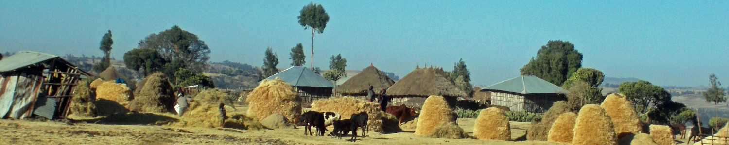
The gas station was open before six and I got a few things before getting on the road. It was cool temperature but not as cold as I expected. The first part of the ride was mostly flat with a gentle climb from 8100ft to 8900ft in the first 21 miles. I saw some curious cows along the way.

At Gould was a small store and stopped in for brief conversation and a chocolate bar. After this slightly more climbing but also some pretty scenery.

At 31 miles I was on top of Cameron Pass

The descent started after that. I remembered the descent though wasn’t as steep as I expected. There was some up canyon wind as well so that slowed things a bit. I stopped for lunch at 57 miles and otherwise kept down the canyon. At the bottom part of the canyon was sections that had been burned by fire last year.

At 88 miles was end of CO 14 and intersection with US 287. I took the back road via Laporte and otherwise cycled through Fort Collins and ended at a storage locker where I had stored things. End of a fun ride that connected Portland with Fort Collins.


Today was a familiar ride, one I’ve done a few times before including a year ago as part of Bicycle Tour of Colorado. It included riding over Rabbit Ears Pass and then down through North Park into Walden.
I was a little slower getting on the road this morning. It was cool so waited a little for it to warm up. The first seven miles were fairly flat as the road followed the valley. Saw a hot air balloon just lifting off.

A little past seven miles the climb begins. It was a steady grade and a straightforward climb. I got to the top at 15 miles and was surprised not to find a “west summit Rabbit Ears Pass” sign, though there were signs warning of the downhills and checking brakes.

After this the road goes up and down a bit as it crosses over to the east summit at 21 miles. This is the location of the Continental Divide

After this, a descent until 25.5 miles. Along the way, you can see the Rabbit Ears for which the pass is named.

and at 25.5 miles is Muddy Pass.

Here the road splits and CO 14 starts with route to Walden and then Fort Collins.

The ride through North Park was reasonable, mostly flat with a few descents. A number of the mustangs passed me coming from Steamboat Springs presumably. It had become overcast and south of me it looked like some rain showers. Fortunately, it was cool but stayed dry. Got into Walden in early afternoon and got a bite to eat before checking into a local motel.


Today was an easier ride mostly following the Yampa River on a gentle uphill slope.
Maybell Colorado holds the record for coldest temperature in Colorado. While it wasn’t close to that, it was still a cold morning and time to put on my long fingered gloves. Otherwise, quiet sleepy little town as I left in early morning. Though, I suspect it would also be a sleepy little town later in day as well.
At three miles crossed over the Yampa River and then followed a drainage up. It was open sagebrush country and fortunately not too much wind. At 12 miles was Lay and then a few miles more and we left this drainage. I could see a large power plant for Craig in distance and last miles into Craig had a good downhill to the Yampa River. Picture below of antelope was taken along the way.

In Craig, I stopped for breakfast and then cycled through rest of town. There was a woodcarving exhibition going on in main park downtown. After this and for rest of the day, followed the Yampa River. I had actually cycled the same route one year ago with bicycle tour of Colorado. It was fairly easy riding and only few small hills.

At 48 miles was town of Hayden and another stop. Outside Hayden was a coffeeshop for sale, shaped like giant windmill. After this the last few miles brought me to Steamboat Springs. The main street was closed off with several hundred Mustang automobiles on display. I also stopped through bike shop since my rear brake was starting to make noises that the pads had worn to metal. Fortunately, able to fix this before larger descents in days ahead.


Today crossed the border into Colorado. This morning as I was leaving Vernal, Erik cycled out the first five miles through town. After leaving town, it was mostly downhill to the Green River at Jensen. The river was wide and I stopped briefly first at a gas station and then across the bridge.

After leaving the river, there was a gentle climb over a hill and then more climbing. A total of 1200ft from the river to town of Dinosaur. Along the way, at 31.5 miles I came to the sign at the Colorado border. Stopped briefly for a photo and then cycled into Dinosaur. There was a Colorado Welcome Center here and a few gas station businesses as well as a motel.

After this took the US40 out of town. There was a slight headwind, but fortunately not too hot. The first miles were gentle grades, but at 55 miles it started climbing. Not very steep, but rest of the route had quite a few hills to climb up and over. Eventually, climbed out of the drainage I was in and could see the Yampa River to the North. However, rather than descending on any single drainage to the Yampa, it seemed to cross multiple ones, going downhill for a bit and then uphill again. Close to Maybell there was a sign for the “I do” fire.

At 90 miles there was one remaining descent and town of Maybell in distance. Here was a small motel, a cafe and a small convenience store. Visited all three and relaxed after a 91 mile day where the last 36 miles had most of the hill climbing.


Tailwinds today, but also cross winds. Also nice chance to visit with friends Jenny and Erik who rode TDA this year from Nairobi to Cape Town. Erik also rode all of TDA in 2011.
It was already windy when I got out on the road at sunrise. The winds were diagonally from the rear and frequently gusty. This meant they helped me along, but also had to be careful about gusts blowing sideways. It was a little more challenging because there was a rumble strip in middle of the shoulder – so couldn’t always ride to right of the rumble strip with gusts and with debris. However, generally worked and even went through one area of construction.

At 18 miles was Myton and a truck stop. It was surprisingly busy and I counted 18 people waiting in line with two cashiers with both cashiers working pretty hard. I was told this was last truck stop before oil fields further west. Outside you could see above that all vehicles were trucks and inside all folks in line were men.
After Myton the road turned and the wind also seemed to get better. This brought me up and through Roosevelt at mile 28. This town was surprisingly spread out going for what seemed like five miles for such a small town. After this went along a Ute Indian reservation near Fort Duchesne and then the farming areas lessened and became scrub brush again. A few hills to go along and then a gradual six mile climb into Vernal.

A good descent and then found a motel to clean up before going over to meet Jenny and Erik at Jenny’s place in Vernal. Much appreciated good conversation and meal that evening. Also briefly went out to find the dinosaurs in Vernal.


Today a shorter day with a large climb. I had considered two possible routes to enter Colorado. The southern route went via Green River and then mostly on old US 6 parallel to the interstate (I-70). The northern route went via Vernal and along US 40. I preferred the southern route but it also had a ~90 mile gap between services. This morning checked the weather forecasts and decided to take the northern route since it was getting just a bit too hot and windy to make the southern route pleasant.
Hence, the first part of the ride was 11 miles back the way I had cycled yesterday. Stopped briefly in Helper and north of there reached the intersection with US 191.

There was a large coal power plant at the intersection.

After the power plant, the road became quiet and quickly started climbing up through a little canyon. There was a lot less traffic here than US6 through there were still trucks and RVs driving this route. By 16 miles I had reached an elevation of ~7000ft and hence was 1500ft above where I had started in Price. At 18 miles there was a road junction and then at 21 miles the grade became steeper and for next five miles it climbed up to the summit. Looking back, the sign said “8% grade 4 1/2 miles” and I think that was about right.

At the summit there were some nice views before the road then descended down into the next canyon. It was a steep descent at first and then afterwards a longer time with good descent where one didn’t need to pedal much. Closer
to the bottom it became a more open valley.

There were multiple cattle guards and also some small pumping oil wells. Overall, it was a nice ride downhill and payback for the climb earlier.

At the bottom was an intersection with US 40 in Duchesne. Duchesne is a town with just one traffic light (and not at US40/US191 intersection) but has some small shops and a good cafe for lunch. Decided to stop for an early day so can come into Vernal tomorrow. Wifi wasn’t working at the motel, but they told me to try the open wifi from a neighboring business.

Today I cycled out of the Utah valley and over to Price. Windy today though a mixture of tail wind and head winds.
In the morning cycled through populated areas. First went to UT 198 and then followed this for five miles before taking a small road 8800. A nine miles this brought me to US 6 and up the canyon. There was a gas station here and chance to get a bite to eat. It was windy here and there were wind mills at mouth of the canyon.

The next 63 miles were all on US 6. While it was a direct route, I wasn’t too excited by this as a cycling route. The was often a reasonable shoulder width but then a rumble strip was placed right in middle of it. Also, there was considerable debris on the shoulder. I had to be careful to avoid the shredded truck tires since the little metal wires can cause flats that are hard to diagnose. The road varied between one lane and two lanes and Utah Department of Transportation (UDOT) tells us the road volume varies between 9000 vehicles per day in the Utah Valley to 4500 vehicles per day near I-70. (In contrast US 50 across Nevada was more typically 800 vehicles per day). So it was also a busy road.
At 15 miles the road started climbing a bit more and also became two lanes with passing lane. It was also marked as construction zone, though the work was recently completed. It looks like they added a new layer of chip seal. The chips were coarse and hence rough riding. This also hid but didn’t get rid of the rumble strip. After three miles of this climb, came to road intersection with US89 and had a slight descent.

Photo above shows sheep I saw along the way that were being herded over top of the mountain. There were also horses and cows along the route. At 34 miles there was a very nice rest area and chance to stop. In addition to rest rooms there were tourist information boards, historical plaques and also this train replica.

After the rest area the road stayed four lanes from here up to top of Soldiers Summit at 42 miles. The last few miles of this climb were road construction. They were milling the old road surface and putting down new layer of asphalt. The road narrowed to a single lane and cars were being shuttled with pilot car through the area. Fortunately, the new asphalt dried quickly and the flaggers allowed me to ride on new portion of the road. There were one or two spots where I needed to carefully go past the active construction, but it was a reasonable ride.

Soldiers Summit was at 7500ft so I had slowly climbed 3000ft over the past 33 miles. From here with one exception a slight descent mostly until mile 54. It was also more open here and hence the winds would push my bike around.

At 54 miles, the downhill became steeper as the road went through Price Canyon. The canyon itself was a nice ride and route continued to alternate between two and four lanes. At 62 miles there was intersection with road to Duchesne and three miles after this it went through Helper. By now the canyon opened up and the route also became flatter. Last miles into Price was on wide four lane road with the best shoulder I had all day. So overall, not too difficult of a ride to bring me across the mountain and down to Price.

Tailwinds made today a relatively easy ride. The first two thirds of the ride was on sparsely populated valleys and then after Eureka I climbed into the basin that was more populated.
The wind was already blowing lightly when I got on the road. Fortunately, it was a tailwind. I followed US 6 out of town. A few miles out I met two cyclists stopped on side of the road. Each towing a two wheel bicycle trailer. I then noticed their bikes had engines and hence they were able to zoom past. Apparently their destination was Wyoming.
Without much difficulty I made it to Lynndyl at mile 16 where photo above was taken. This was good place for a few more breakfast items. After this the road split and I took the less populated one. It had a few gradual ups and downs but nothing too severe. There was rest area near 39 miles and then this research area sign shortly after that.

At 49 miles the road split and then went through a gap in the mountains with two miles of gentle climb to Eureka. It didn’t look like much was open in the main street of Eureka. I did find a gas station for chance to get lunch at 51 miles.

Also nearby was the Porter Rockwell Cabin.
After this finished the climb out from Eureka and had a good descent on other side.

At 66 miles I took a back road through Genola and then past a rocky quarry and many orchards to ride the back roads into Payson. Overall a fairly easy day made a bit easier by a nice tailwind. Will have to see how these winds continue since after tomorrow need to decide whether to follow I-70 route or US 40 route.
Today was a quiet rest day in Delta. Got laundry done and checked maps for next possibilities. I also bicycled out to the internment camp outside town and then back. Below are some photos from the trip to the camp.
Monument in Delta describing the camp.

Riding out to camp was ~15 miles of which 10 was paved. It was nice to ride without my extra gear.

Main entry to the camp. There were black and white signs for various places such as hospital, schools, fire station, post office, military police and also for different residential blocks.

Place where one of the barracks would have stood. Each barracks was 120×20 and there were 12 of them arranged in each block. These were then divided into six apartments. Hence, each block had between 200 and 300 people. There was a dining hall and latrine/laundry building on each block.

Monument on the northwest part of the site.

One of the plaques at the monument.

Barracks buildings aren’t there anymore, some have been reused as parts of houses as apparently was done on this house.
